

Rayne Heritage Trail
The Rayne Heritage Trail has been created as part of a commitment to the Heritage Lottery Fund, in return for its generous support for the renovation and repair of All Saints Church. The project coincided with COVID-19, when the inhabitants of Rayne returned to a state of lockdown last experienced in 1665. It is hoped that those following the Heritage Trail will enjoy the experience and gain an insight into Rayne’s past and present.
Heritage Trail
Rayne has a rich heritage, with All Saints Parish Church as a centre for its community for over 1,000 years. It has a current population of around 2,300. The Rayne Heritage Trail offers a circular walking route that highlights some of the 67 Grade I and II listed structures in Rayne. The route is considered “easy” walking. If taken at a reasonable pace, it should take approximately 1¼ hours to complete.
Roman Period
Rayne’s central axis, “The Street” maintains the line of the major Roman road, “Stane Street”, from Colchester to Braughing in Hertfordshire. Although Braintree had extensive Roman industrial activity, little has been found at Rayne. Limited excavation has revealed agricultural activity with field systems and enclosures, along with evidence for a potential Roman heated building somewhere in the vicinity.
Saxon & Norman Periods
Rayne was part of the Saxon administrative area, known as the Hinckford Hundred. It was the 10th largest village, with Finchingfield the biggest and Braintree the smallest.
Rayne has 5 entries in the Domesday Book, listing a range of ploughland, meadow and livestock, plus mills. It was assigned the highest amount of tax in the Hundred. Domesday also records 15 slaves in Rayne – people with no property, who could be bought or sold by the Lord.
Modern History
Rayne maintained its agricultural basis for many centuries. Gradually consolidation occurred, so by 1800 almost all the land was owned by a dozen farmers. The arrival of the railway in 1869 enabled the agricultural produce to be transported to London, whilst providing the catalyst for the expansion of industrial activity at Rayne Foundry. Both World Wars saw members of the village answering the call to arms, whilst others produced munitions at Rayne Foundry, or vital food supplies. Households also provided billets for soldiers of the Sherwood Foresters and King’s Royal Rifles during WW2.
Major changes occurred towards the end of the 20th century. Rail services ceased in 1971, and the track was removed soon after. The old line became the Flitch Way Country Park in 1994. Rayne Foundry closed in 2001 and as industry retreated, land was reused for housing, leaving the village that is seen today.
Heritage Trail Locations
1. Rayne Village Hall
2. The Swan
3. War Memorial (Grade II)
3a. Commemorative Stone
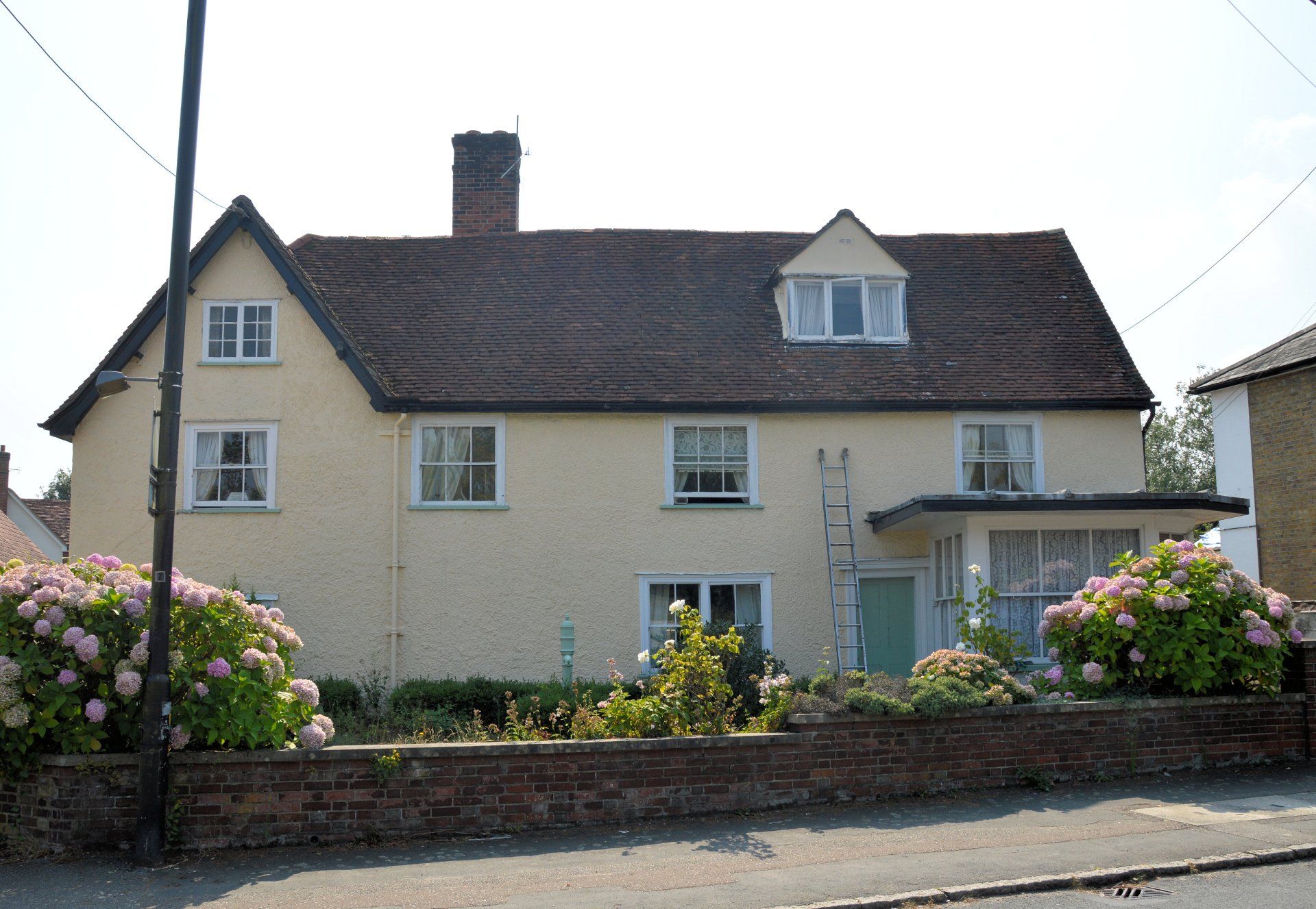
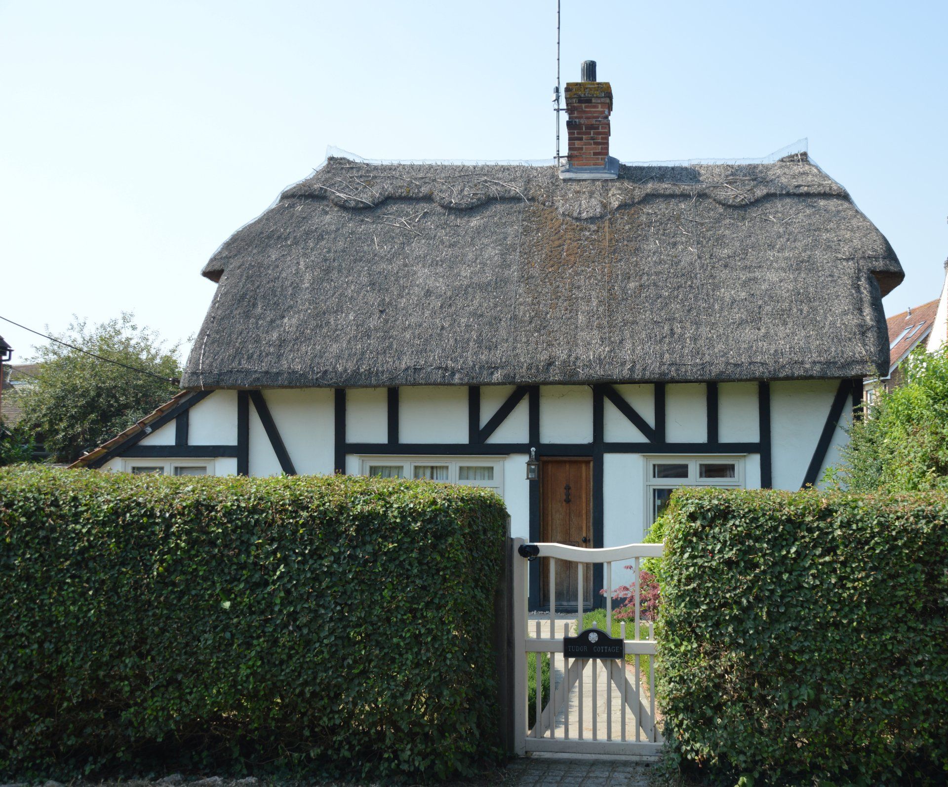
4. Tudor Cottage (Grade II)
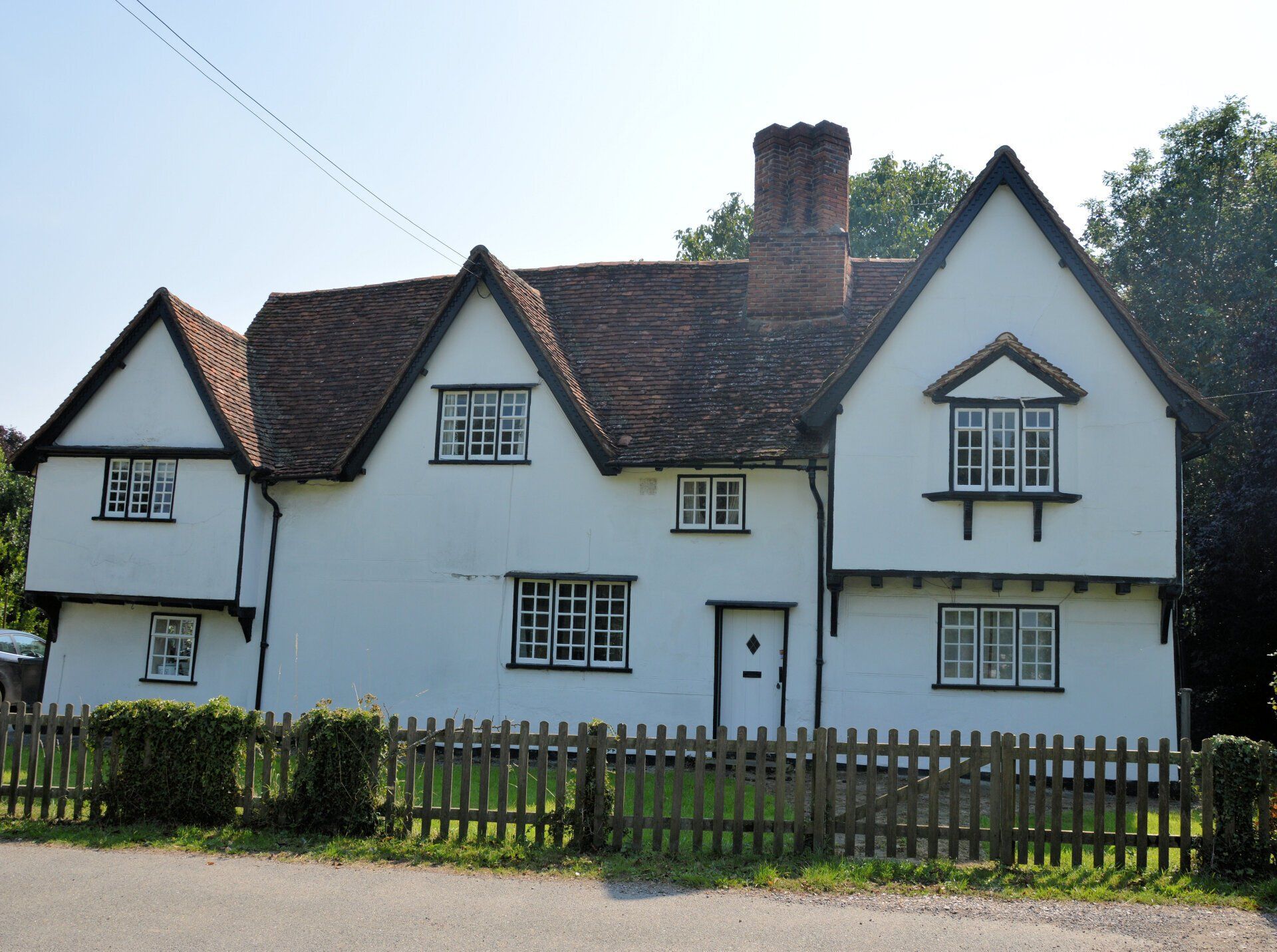
5. Rayne Hall (Grade II)
6. All Saints Church (Grade II)
7. Mary's Cottage & Lockup, Village Pump (Grade II)
8. Old School House (Grade II)
9. Rayne House (Grade II)
10. Turners (Grade II)
11. Netherhouse (Grade II)
12. Medley House (Grade II)
13. 17 The Street
14. The Welsh Princess
15. Rayne Foundry (Site Of)
16. Rayne Station (Grade II)
17. Marchants (Grade II)
18. Quincies & Lavender Cottages (Grade II)
19. 5 Gore Lane (Grade II)
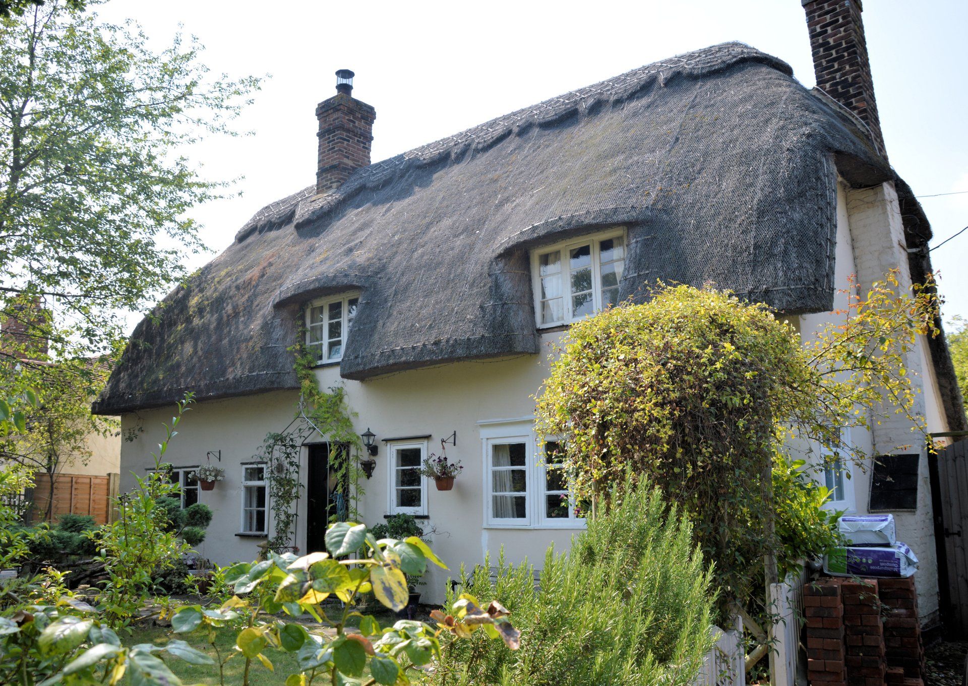
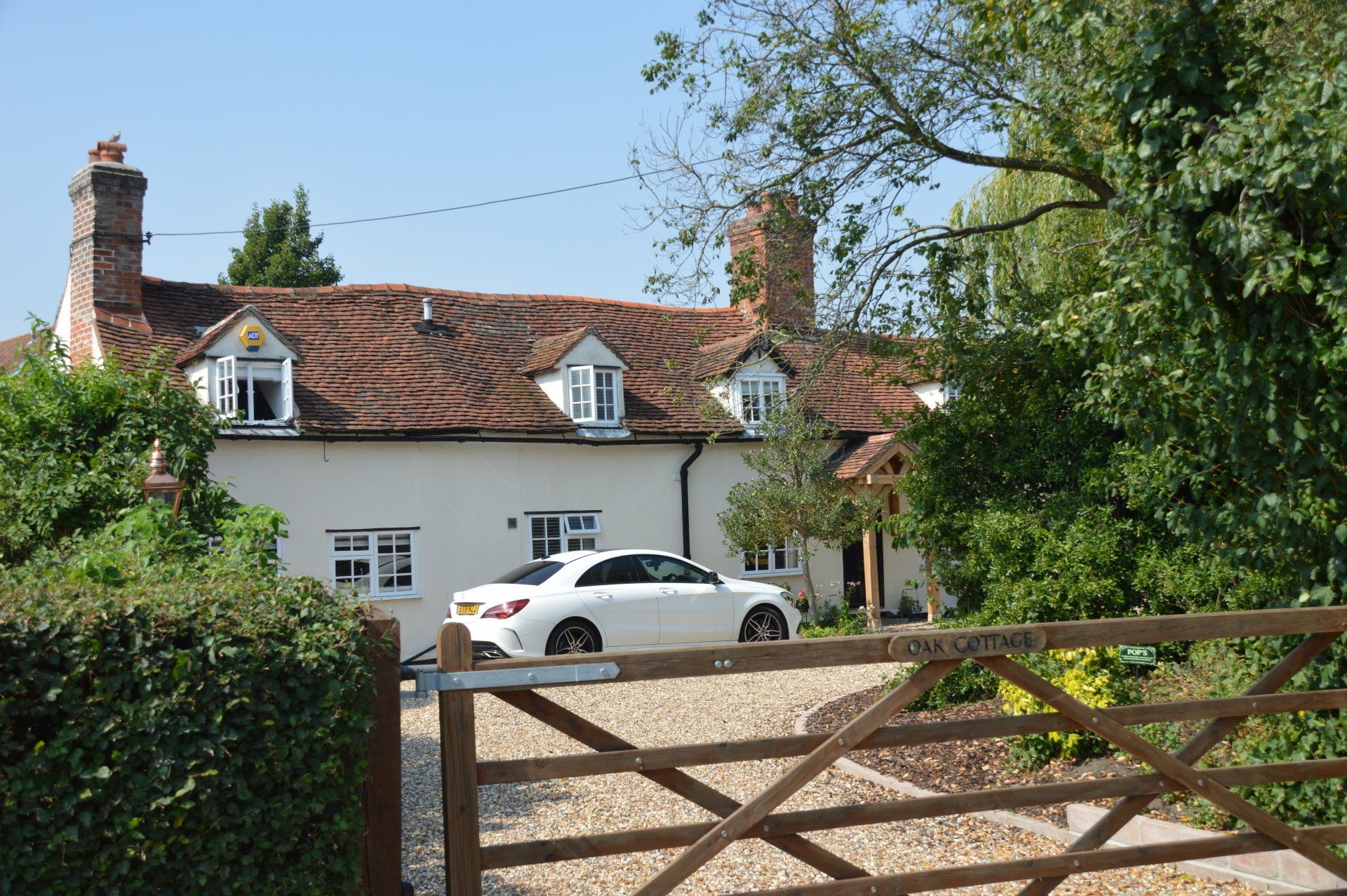
20. Oak Cottage (Grade II)
21. Tudor Cottage (Grade II)
Finish
Rayne Village Hall Car Park. Exit the car park, turning right towards the traffic lights.
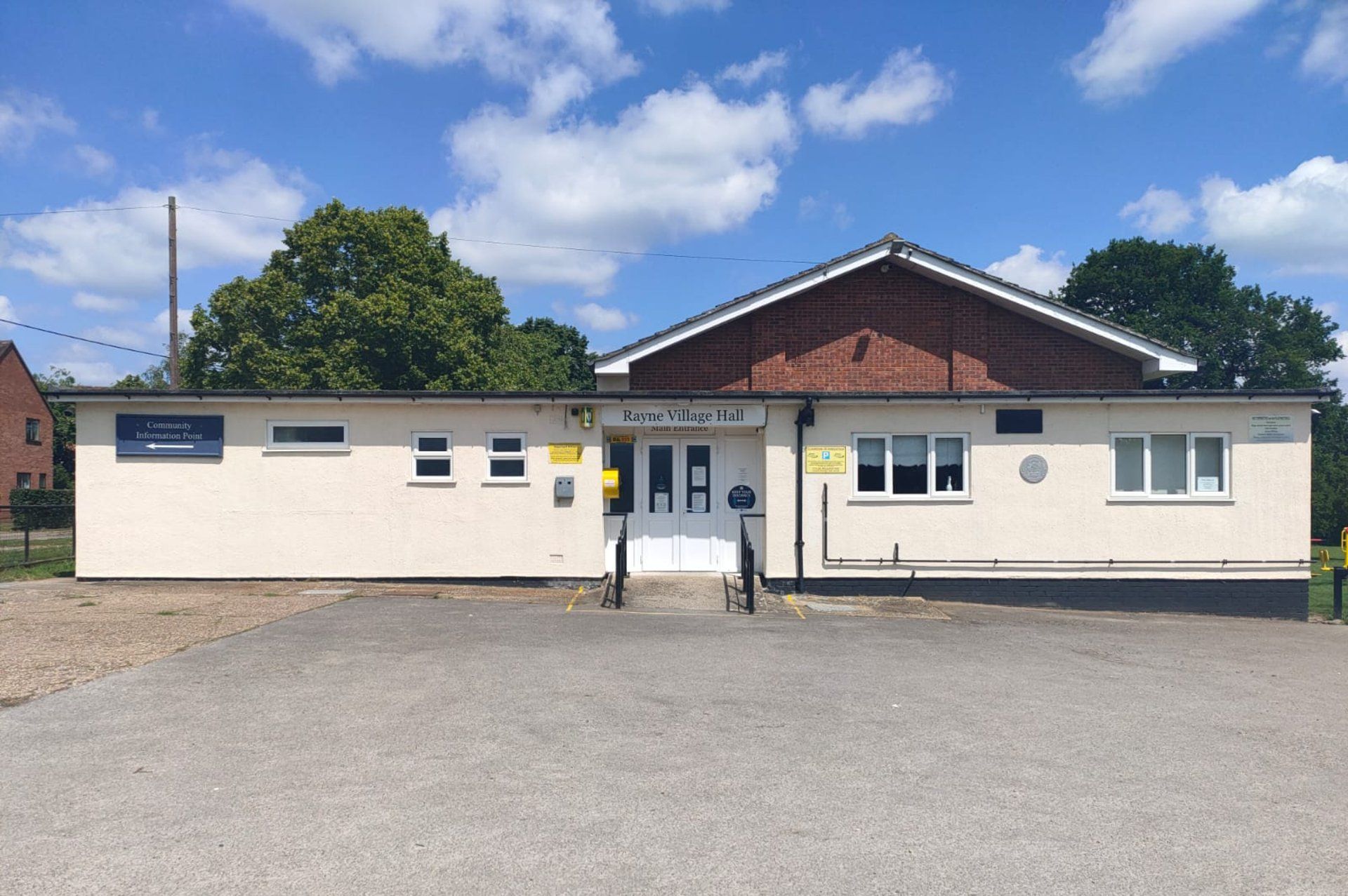
The original village hall was moved to this location in 1955. In 1962, the Parish Council leased a parcel of land - the village hall site and play area - for 99 years. The current building opened in April 1975.
Cross The Street using the pedestrian lights on the left. Turn right and pause by the railings opposite the Swan pub.
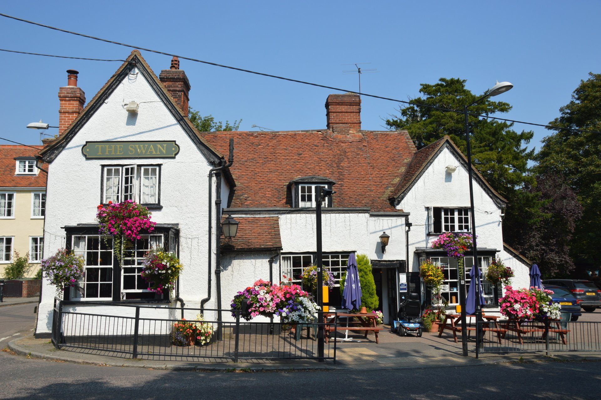
A public house, 16th century or earlier, with later additions and alterations. Previously, also known as the Black Swan. It acted as the post office in the 18th century. Try to spot the Swan in the thatch.
Walk up Shalford Road, to Rayne Hall Green. Cross over to the War Memorial.
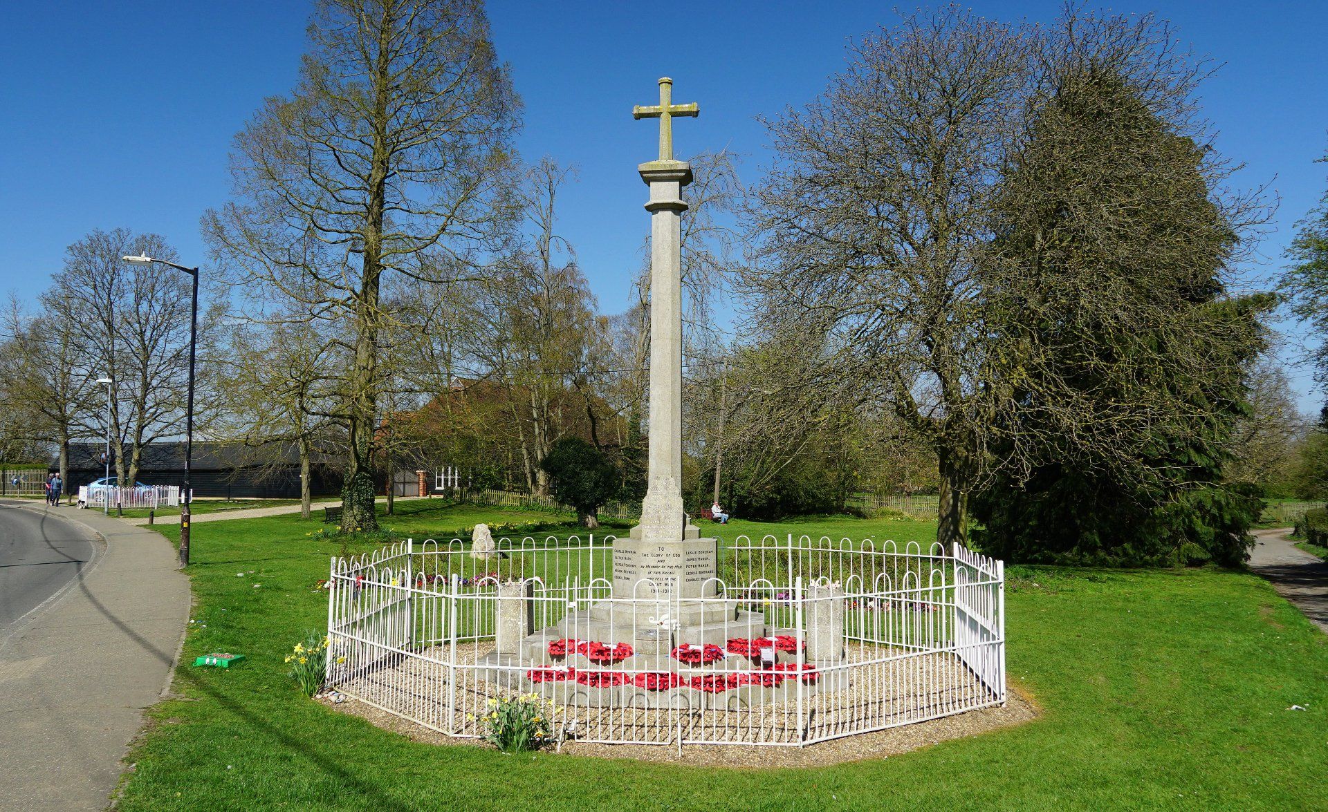
Marks the spot where the volunteers assembled in Oct 1914. During WW1, a total of 107 men enlisted, with 33 men failing to return. The memorial was erected in Oct 1920 for £150, funded by public subscription. The names of 7 men were added following WW2.
Located close to the war memorial.
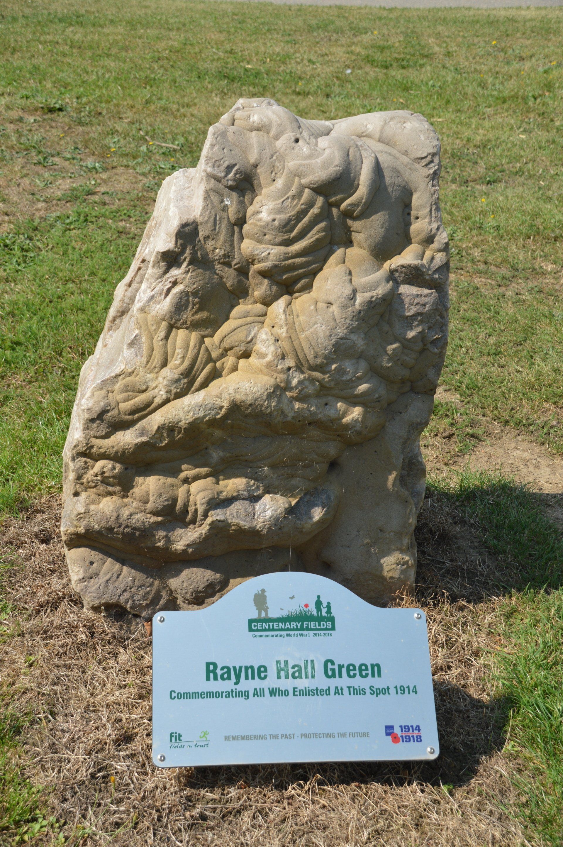
A one tonne stone from a quarry near where the WW1 Armistice was signed. It commemorates everyone who served in the Great War. The stone was donated by the French town Verberie, which has been twinned with Rayne since 1994.
Continue to the right of the War Memorial, up Church Lane towards the church.
Early 16th century house, considerably altered in the 17th century. It is a Hall house with cross wings, east and west. The upper storey projects to the front.
Pause by the field gate opposite the church car park to view Rayne Hall.
With 14th century origins, it was altered in the late 15th century and remained with the Capel family until 1621. Reductions in size in the 17th century created its current form. The Earls of Essex owned the Hall until 1900.
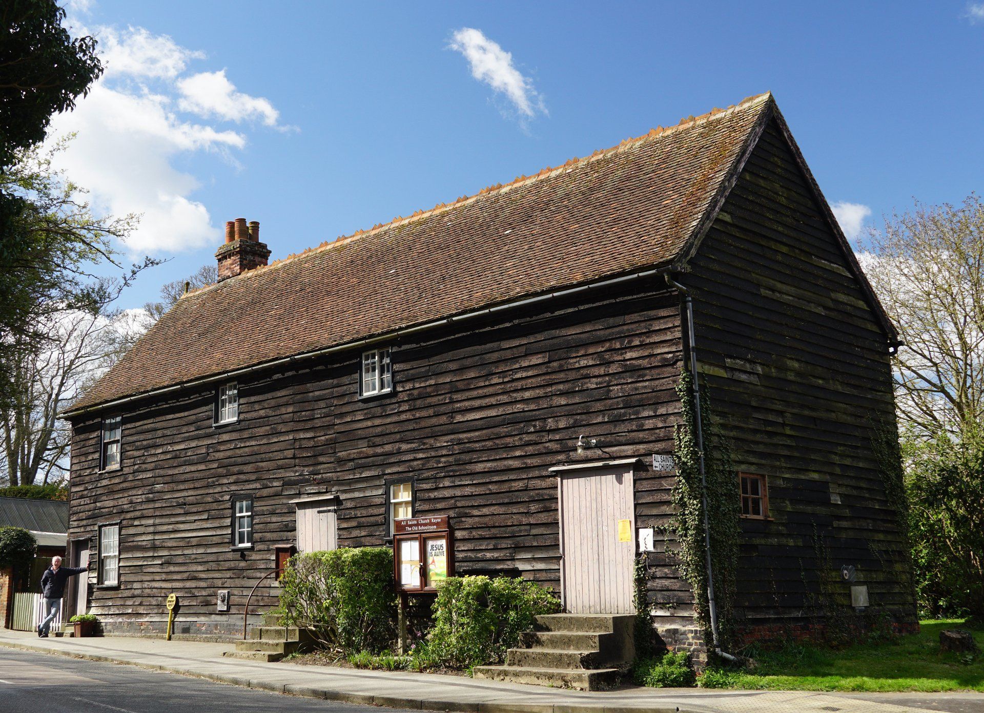
Pause by All Saints Church
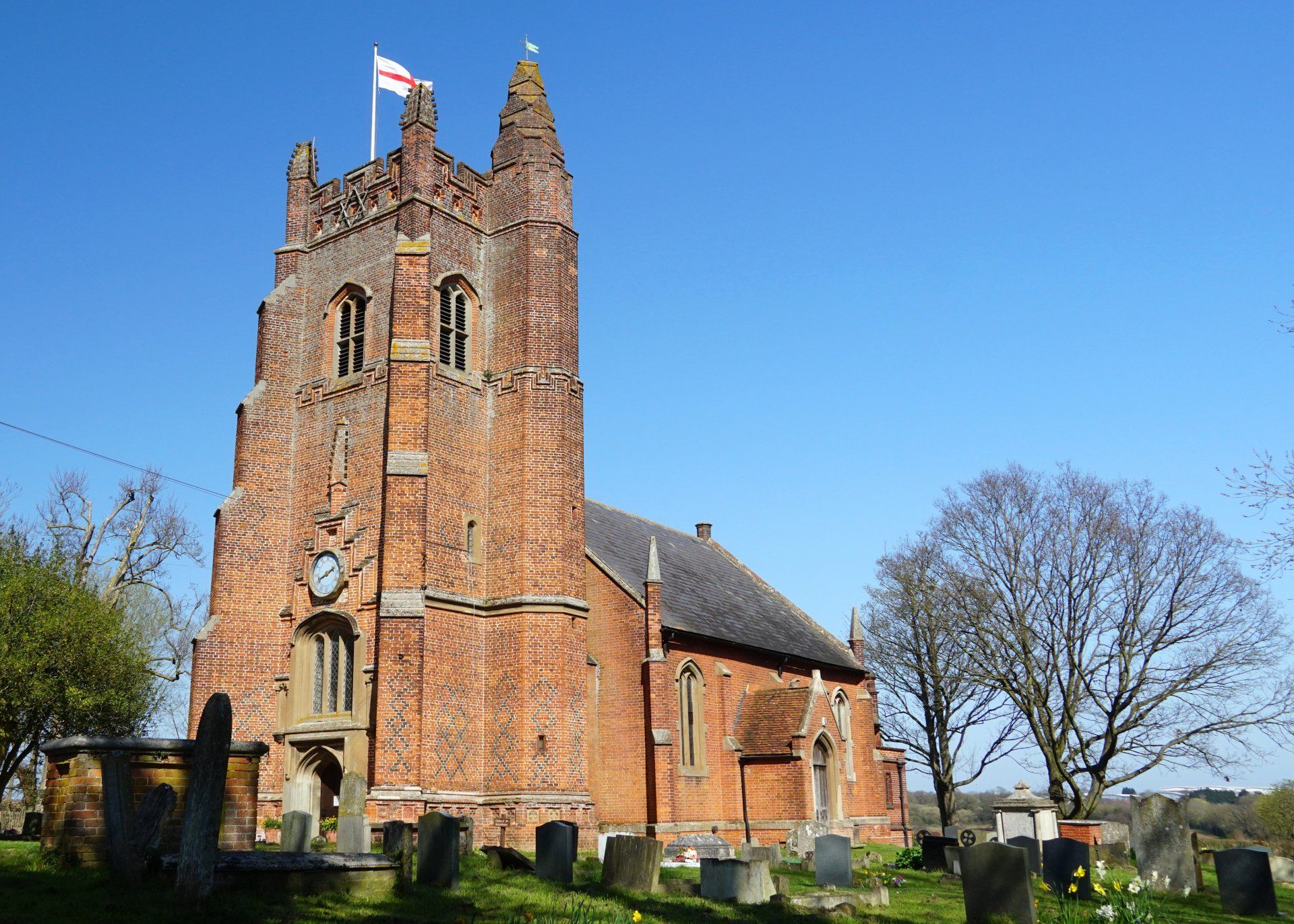
A possible Saxon church was replaced in 1199 by Robert de Welles and Harry de Reynes, with a Norman Nave and Chancel. The West Tower was added around 1510 by Sir William Capel.
The Nave and Chancel were replaced in 1840-41 whilst the Sanctuary and Clergy Vestry were added in 1914. A separate guide is available for the Church.
Retrace your steps down Church Lane. Turn right at Shalford Road and head for the white railings past the War Memorial.
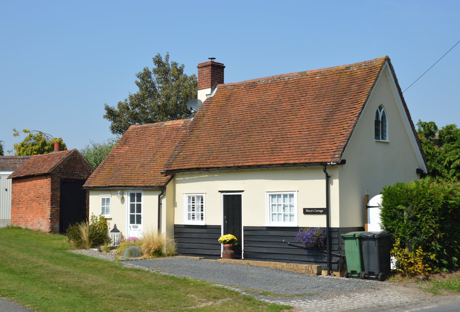
A small 18th-19th century tiled cottage with Gothic headed windows. Behind is a red brick building with an oak door. This is a Lock Up, built in 1819. It was used to hold prisoners and drunks, usually just overnight.
Opposite, set inside a small enclosure, is a 19th century Village Pump. It was made by Appleby & Co., Chesterfield.
Return along Shalford Road towards the traffic lights, crossing the road at The Maltings.
A weatherboarded building, formerly a malthouse, owned by John Hance. Bought in 1844 by Rev. Thomas Willis for £155, it was used as a school until 1878. To the rear is an extension built in 1928. It provided a home for the lending library, which gradually grew to over 5,000 volumes.
Return to The Street, turn right - remain on the same side of the road.
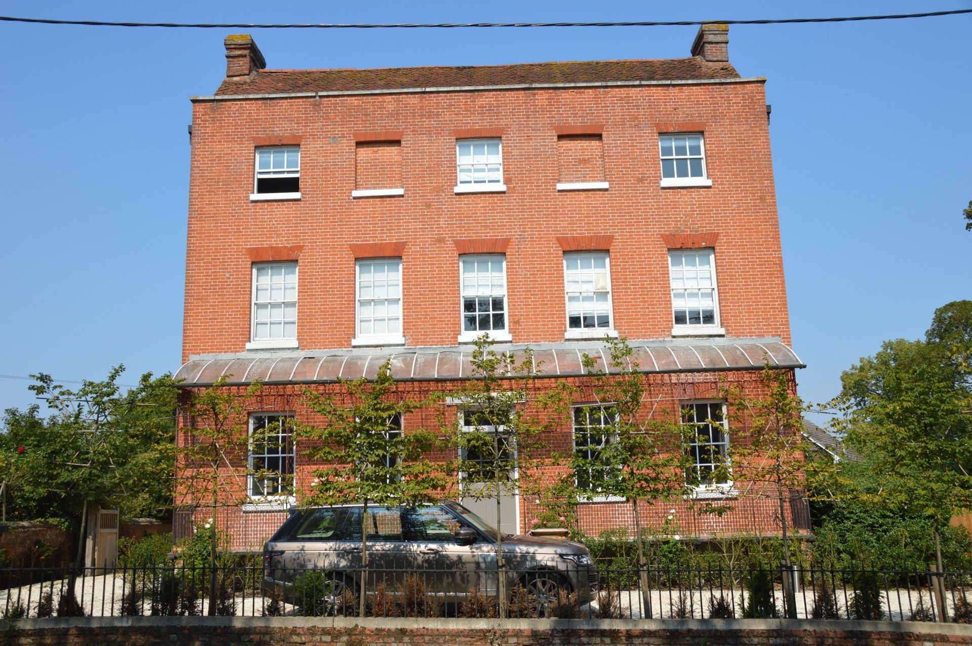
An 18th century red brick building, with a cast iron ground floor veranda. Built by John English, a Braintree Wool Merchant, in 1771. Formerly used for a boys school (run by Julia Dunbar), it is where the Home Guard assembled during WW2.
Continue along The Street to Turners.
A 17th century house, much altered in the 18th and 19th centuries. In 1895 it was bought by Miss Eliza Vaughan, a local historian, naturalist, suffragist and Rayne Parish Clerk who lived here until her death in 1949.
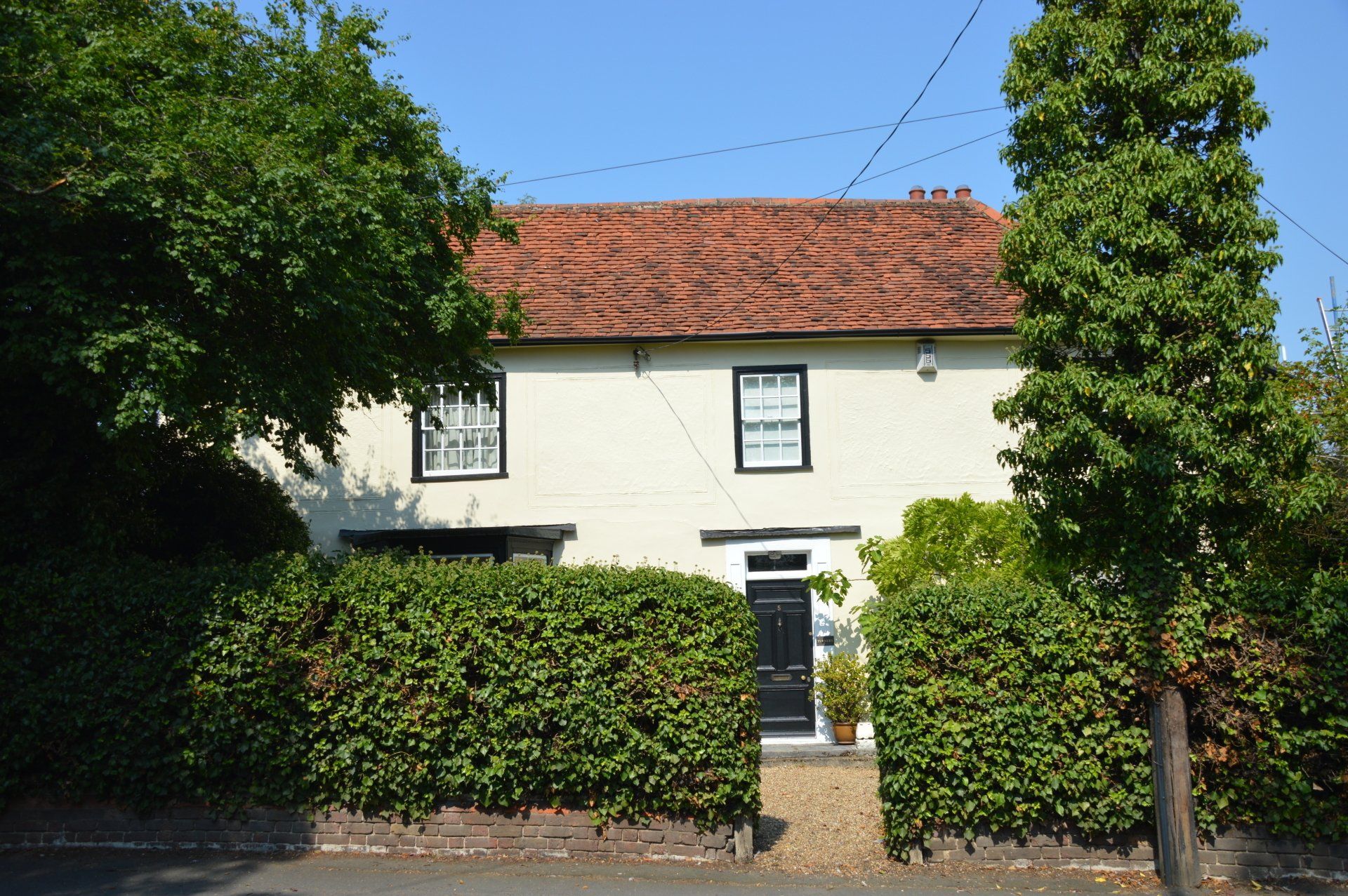
Continue along The Street to Netherhouse.
A 16th -17th century building which was altered and enlarged in the 18th century. A Cypress tree was planted by Frederick Crompton Lake around 1874, hence it also being known as Cypress House.
Continue along The Street to Medley House.
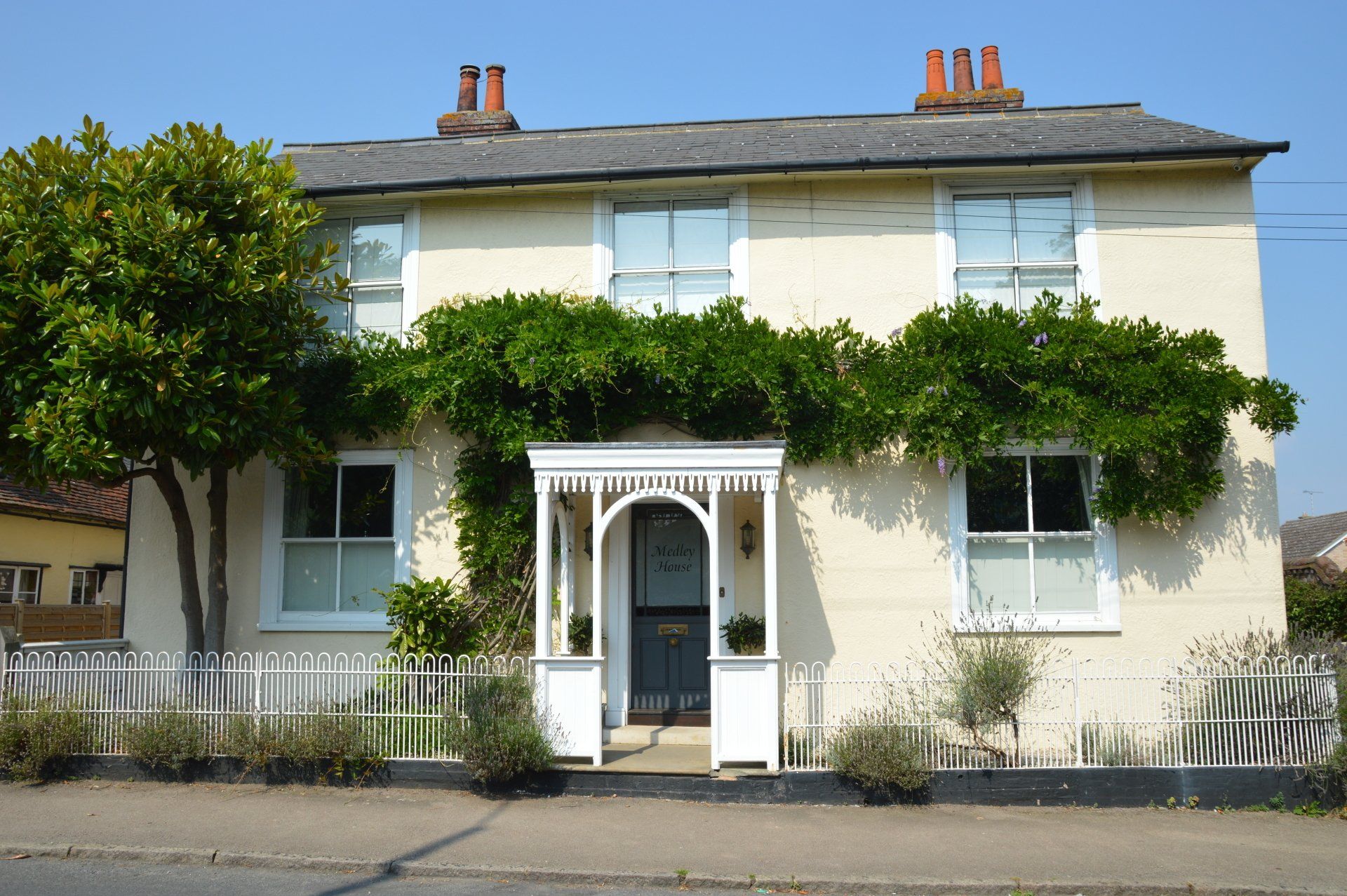
An 18th Century timber framed building. The moulded canopy for the porch and hooped cast iron railings are noteworthy.
Continue along The Street to Voujon restaurant.
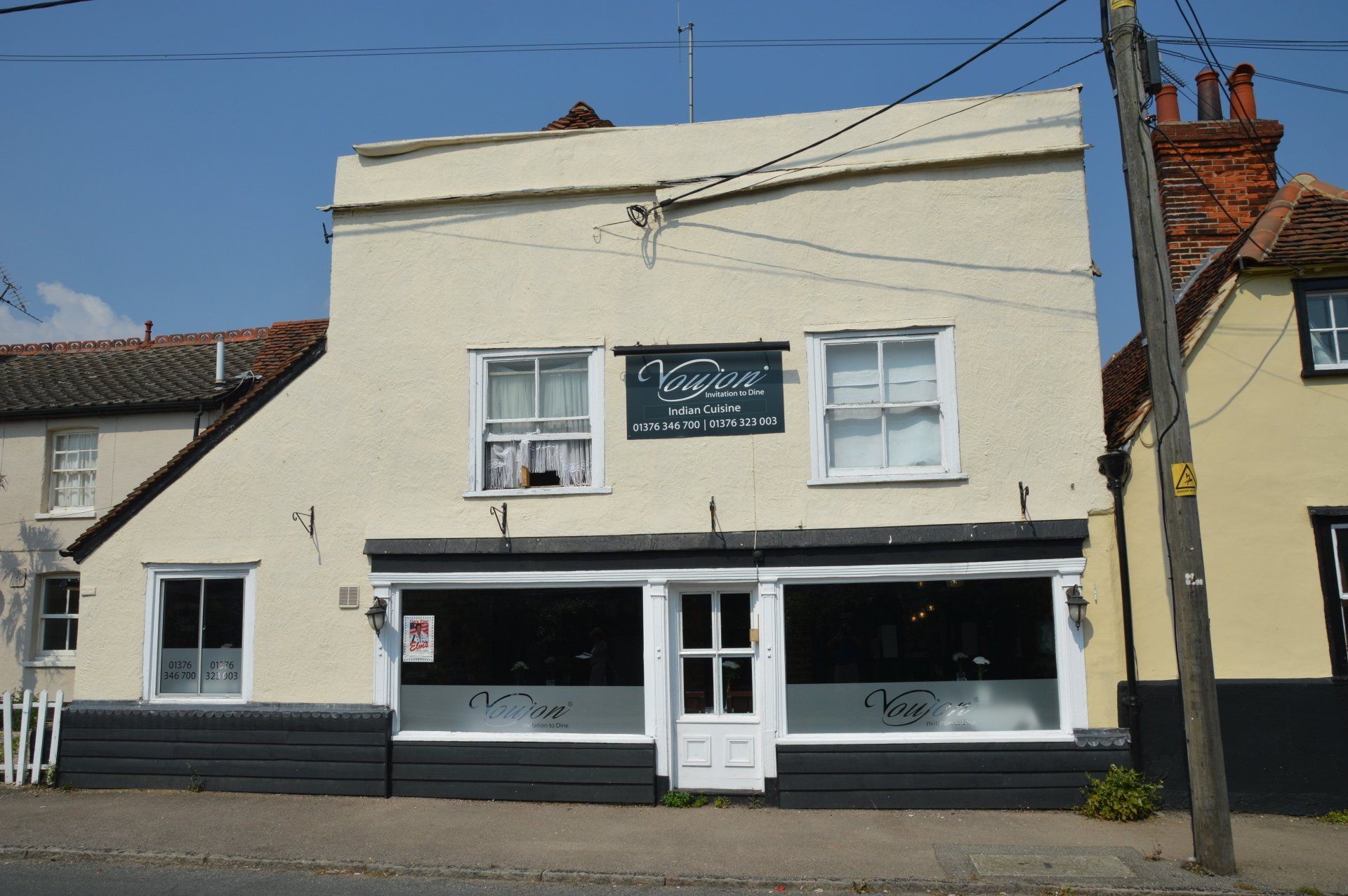
Possibly 17th Century or earlier, with an 18th century shopfront. Currently run as the Voujon restaurant. It was formerly an antiques shop and the Old Post Office.
Continue along The Street to The Welsh Princess public house.
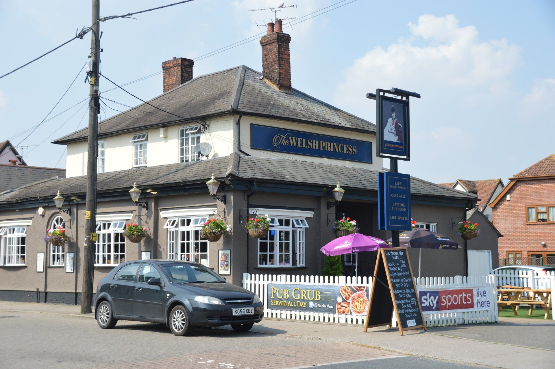
A 19th century public house originally called The Cherry Tree until it was renamed in 1981 in honour of H.R.H. Diana, Princess of Wales.
Continue along The Street to Foundry Way.
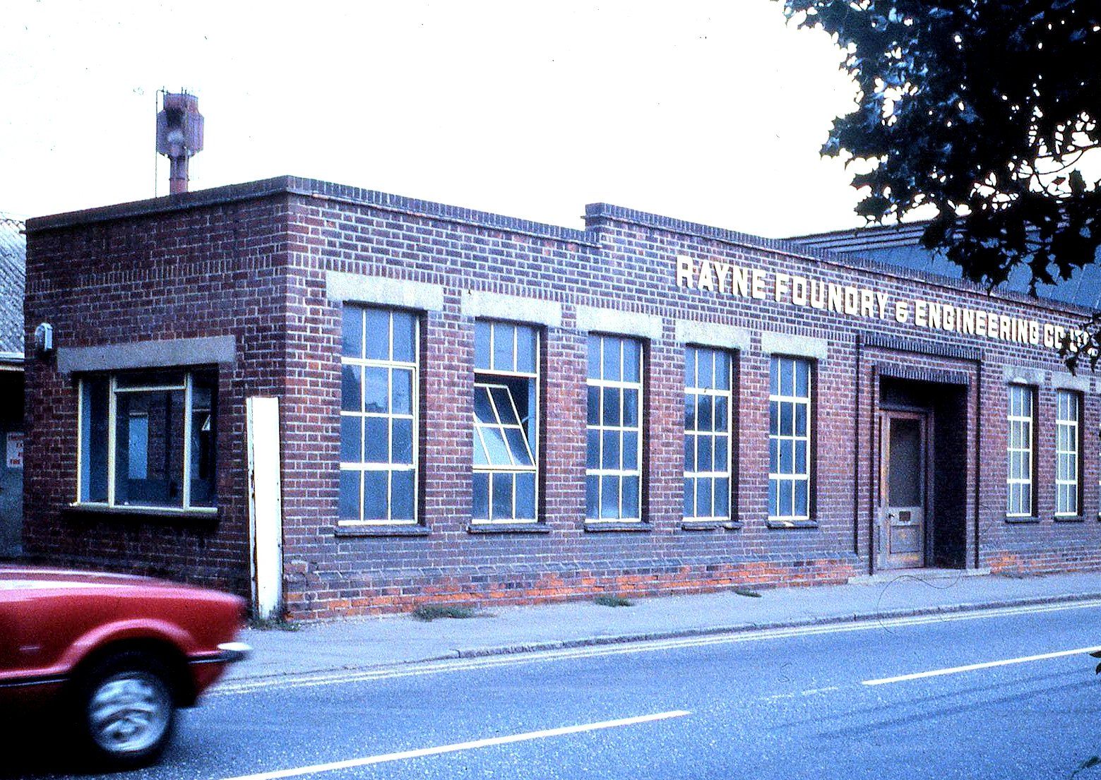
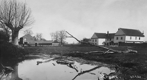
The new buildings occupy the former site of Rayne Foundry which began in the 1820s producing socketed ploughs. It cast in brass, bronze, gunmetal and later aluminium. The Foundry closed on 13 February 2001. Photograph taken by Maurice Totham.
Cross over the pedestrian crossing at the Post Office, continuing until Station Road. Turn left into Station Road and walk until reaching the Flitch Way. Turn left after the white gate and go up onto the platform for access to the café.
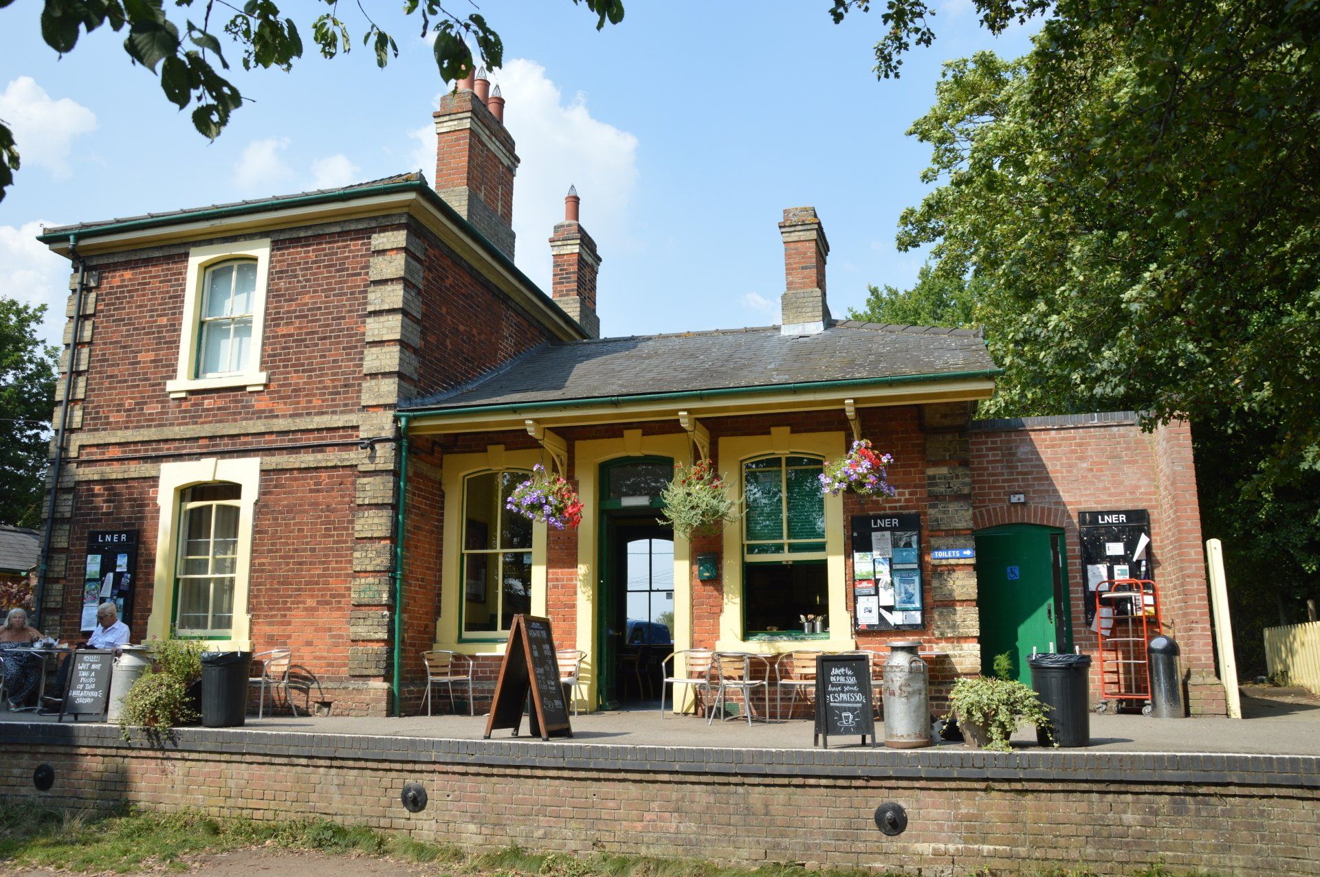
The Bishop’s Stortford to Braintree Line was opened in 1869 to transport malt and barley, but with few passenger trains. Regular passenger services ceased in 1952, with all freight traffic stopping by the end of 1971. The Cafe opened in 2007. The railway carriage has been a museum since 2013, and may be open during your visit. Close by is the site of the Rayne Millennium post.
When ready to leave Rayne Station, from the café, go past the railway carriage and rejoin the Flitch Way towards Braintree.
After crossing Warner Close, leave the Flitch Way at the next footpath on the left, via the gate.
Continue past the garages (Symmons Close).
Cross Medley Road, walk up the footpath until a wall, then turn right and past the railings.
On reaching The Street, turn right, back towards the traffic lights.
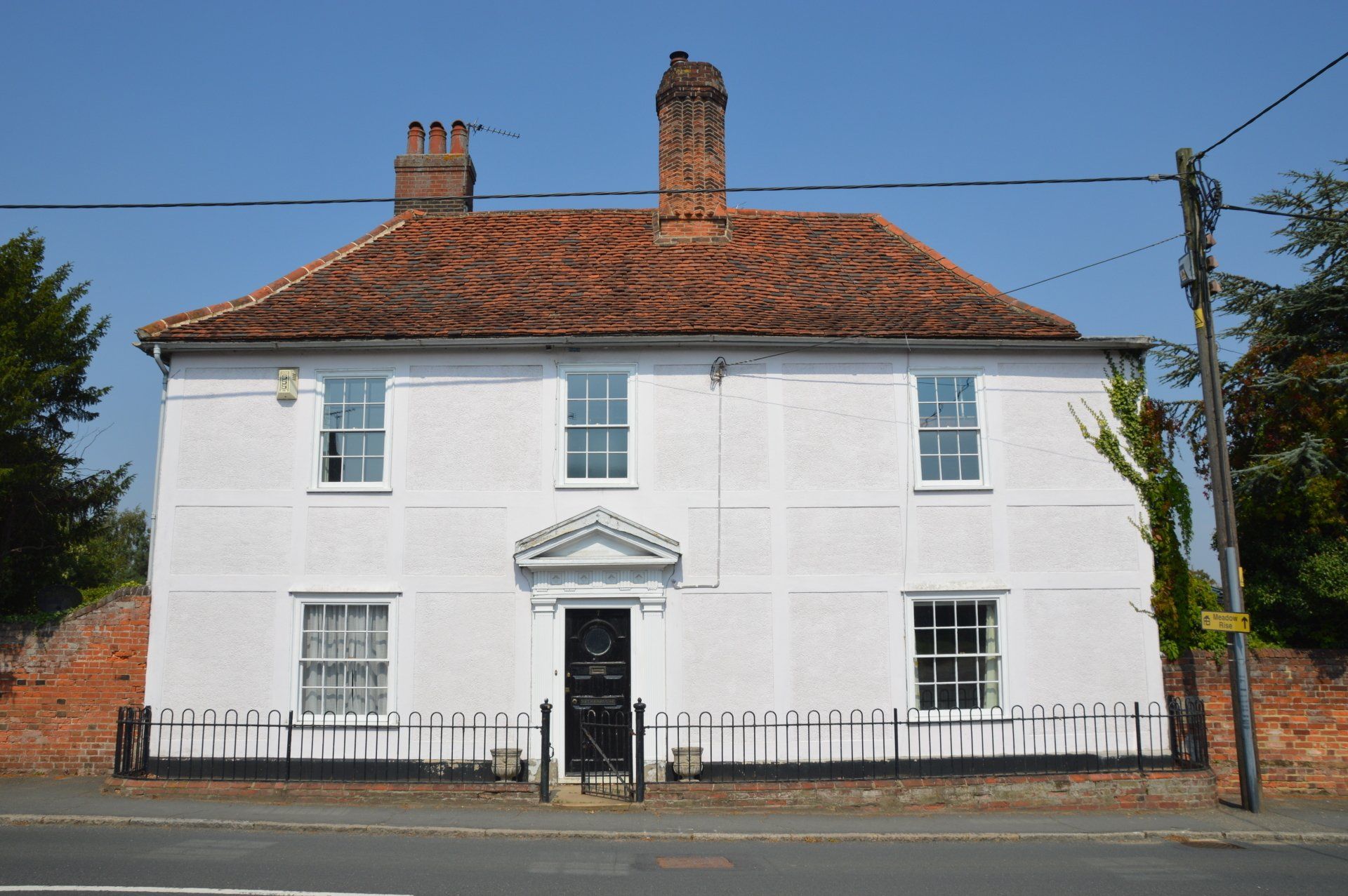
Walking along The Street, Marchants is on your right.
A 17th-18th century or earlier building with later alterations. It has been both a residence and a butcher’s shop. The Pump in the front garden is 19th century. Mains water was not available in Rayne until 1940.
Continue along The Street, then turn right into Gore Lane.
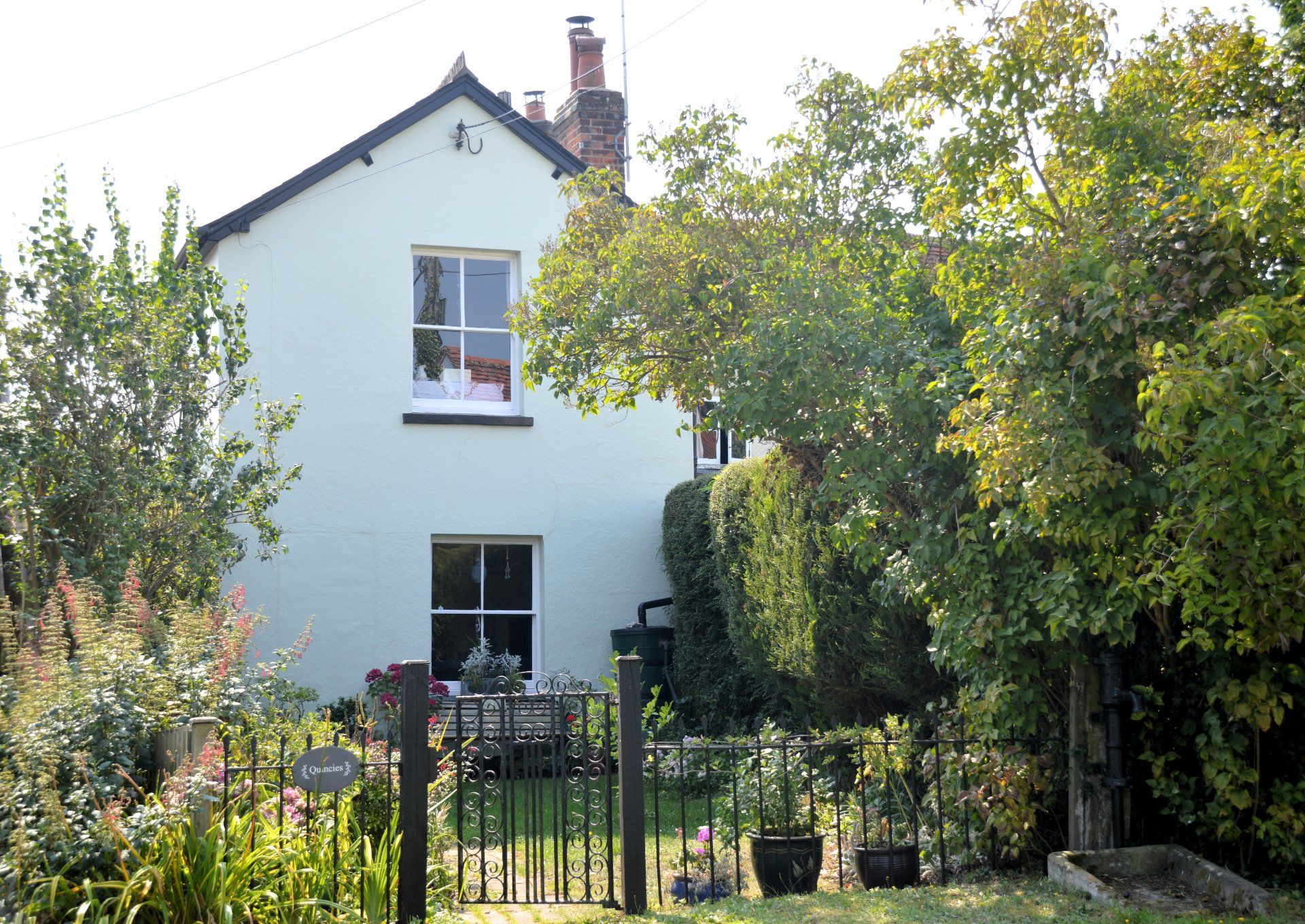
These attached cottages are 16th – 17th century or earlier. They are timber framed and parget plastered. The front room of Quincies served as the police station until 1971. In front of the cottages is another 19th century cast iron suction Village Pump.
Continue along Gore Lane.
A 17th century or earlier cottage. Once two dwellings. It is timber framed and plastered, with a thatched roof.
Continue along Gore Lane.
A 17th century or earlier cottage, with later additions and alterations. It is timber framed and plastered with a red tile roof.
Continue along Gore Lane.
An 18th - 19th century or earlier cottage. It is timber framed and plastered with a thatched roof. Formerly used as a Dame school, run by Miss Tepper.

Take the left fork where Gore Lane splits.
On reaching Gore Road, turn left. Your starting point is on the opposite side of the road.
We hope that you have enjoyed your walk around the Rayne Heritage Trail.
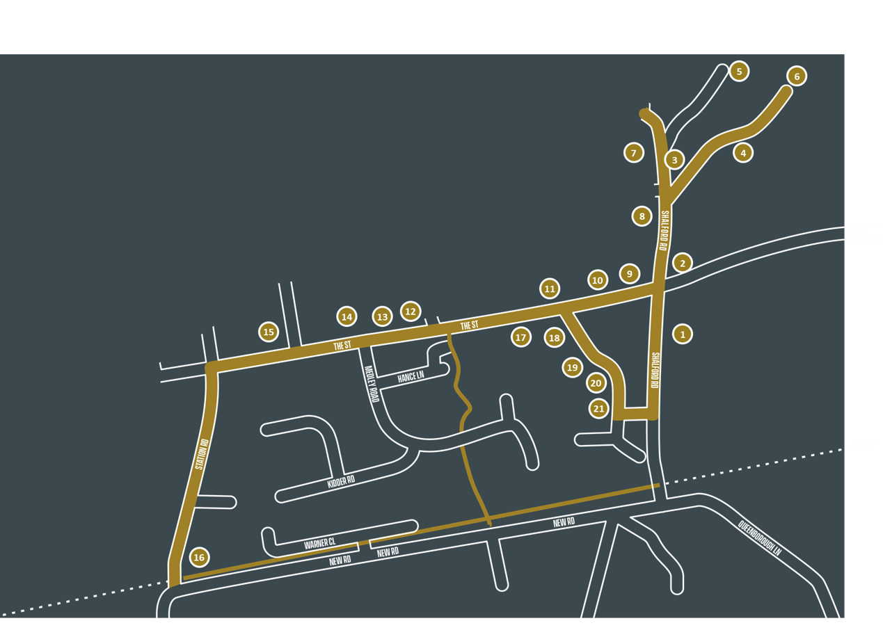
Heritage Trail Map
The Risk Assessment for the Rayne Heritage Trail can be viewed here.
Heritage Tours Calendar

29
30
1
2
3
4
5
6
7
8
9
10
11
12
13
14
15
16
17
18
19
20
21
22
23
24
25
26
27
28
29
30
31
1
2